Land Use Planning Studio Module: Local Development Plan for Dambulla

Thrilled to share the recent group project done by the students of the Department of Town and Country Planning, University of Moratuwa, for the Land Use Planning Studio module: the Local Development Plan for Dambulla! This collaborative effort between Level 2 and Level 3 students was an incredible journey that enhanced our technical and analytical skills through immersive field visits and problem-based learning.
At the core of the development strategy is a transit-oriented approach, designed to prioritize efficient transportation systems and compact urban design. This approach aims to improve accessibility, connectivity, and sustainability within Dambulla, encouraging the use of public transit and promoting walkability. By seamlessly integrating transportation infrastructure with urban development, strive to create a more livable and environmentally friendly cities.
The project was mentored by Dr. Amila Jayasinghe, Archt. Daitha Dharmasena, and Mr. Hashanka Galagedara. Special credits to the Location-based Services to Intelligent Transport Systems (Lbs2its) project, which has been funded by an Erasmus+ Grant.

Capturing Walking Speed under using Mobile Sensors and Machine Learning

The experience of capturing walking speed in and around the University of Moratuwa has been explored using real-time data from mobile phone sensors. This study focused on walking behavior on different road types near the University of Moratuwa, specifically examining walking speed, time, and direction.
The Sensor Logger app, QGIS, Google Colab (a cloud-based Jupyter Notebook environment for Python), and Microsoft Excel were utilized in this research. By applying K-means clustering, 622-speed clusters were identified during specific morning and evening hours. This method reveals mobility patterns, providing valuable insights into pedestrian walking behavior.
Additionally, a manual was prepared to guide others in capturing walking behavior. The guidance and support of Dr. Amila Jayasinghe, the supervisor, were instrumental in this research. The Location-based Services to Intelligent Transport Systems (LBS2ITS) project, funded by an Erasmus+ Grant, provided the necessary support and cutting-edge resources. This project offered an opportunity for technological exploration.

Evaluating Medium-Sized Cities' Progress Towards Achieving the 15-Minute City

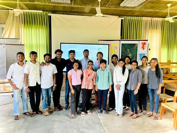
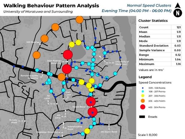
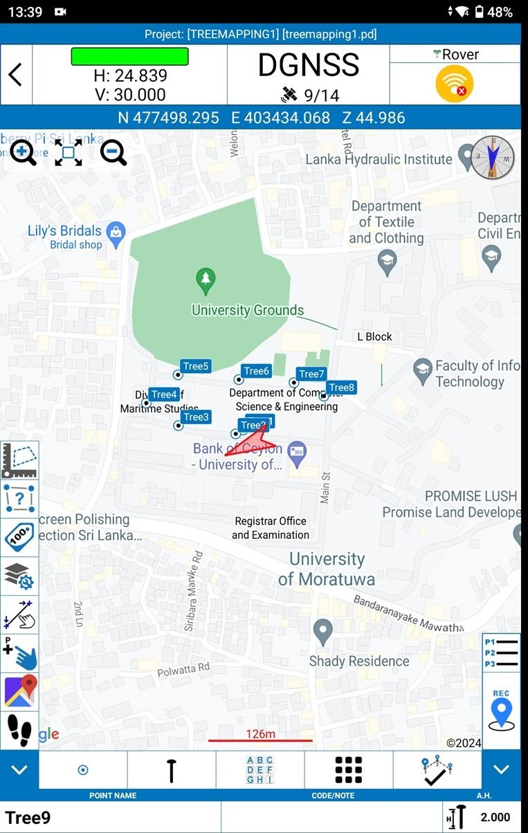
Research team, Department of Town and Country Planning, University of Moratuwa is pleased to share the latest study on the 15-minute city concept. A 15-minute city ensures that all essential services are within a 15-minute walk or bike ride, promoting sustainability, livability, and resilience through mixed-use development, active transportation, green spaces, local services, and community engagement. This study focused on identifying cities in Sri Lanka that qualify as 15-minute cities by analyzing the spatial distribution of eight key services.
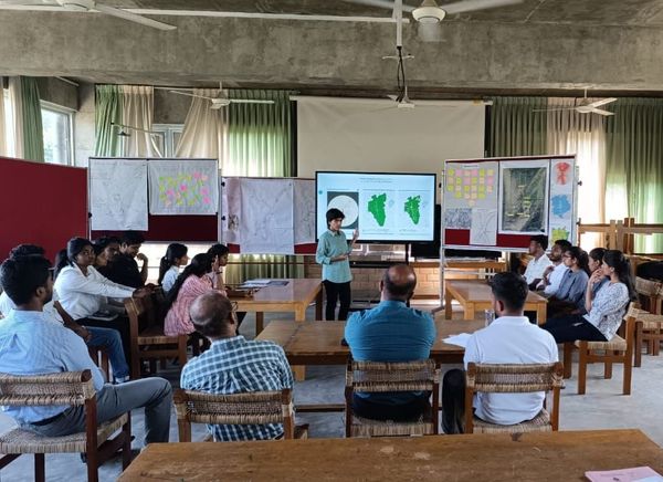
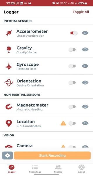
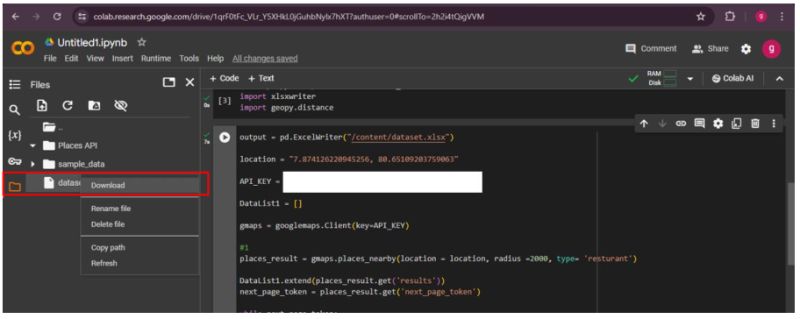
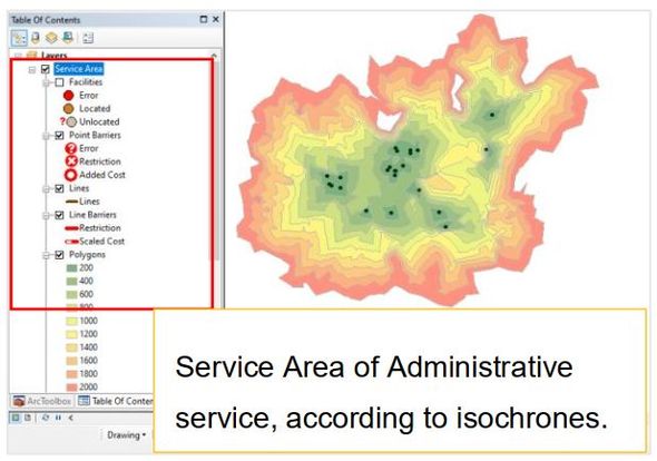
To achieve this, ArcMap, QGIS PRIZREN 3.34 (with the ORS Plugin), and the Google Cloud platform were utilized to extract and analyze Point of Interest (POI) data for these services. The study involved detailed spatial analysis to map out the distribution of the selected service categories, ensuring a comprehensive understanding of their accessibility within the urban landscape.
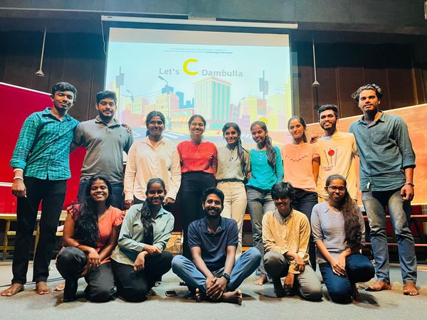
Additionally, a manual was developed to demonstrate how to capture and assess cities based on the 15-minute city criteria using the distribution of the eight service categories. This work was part of the LBS2ITS project, co-funded by the Erasmus+ Programme of the European Union, which offered a valuable learning experience in location-based studies. Gratitude is expressed for the opportunity to expand knowledge in this field and contribute to such an impactful study. Thank you for this enriching experience.

Utilizing the S70G tablet with the Global Navigation Satellite System (GNSS) for high-accuracy GPS data collection

The tree mapping study at the University of Moratuwa was an invaluable experience for the team. Utilizing the S70G tablet with the Global Navigation Satellite System (GNSS) for high-accuracy GPS data collection, the trees were mapped precisely. The map preparation was conducted using QGIS 2.18. This marked the second study involving LBS applications for the researchers. This experience allowed the team to gain practical knowledge with cutting-edge geospatial technologies, integrating various data layers, performing spatial analysis, and producing detailed maps essential for environmental management and urban planning. The GNSS technology’s accuracy guaranteed the reliability of the data, making it suitable for crucial decision-making processes.
In addition to the technical skills, the project culminated in the creation of a manual for tree mapping with the S70G tablet and GNSS technology. This opportunity was facilitated by the Location-based Services to Intelligent Transport Systems (LBS2ITS) project, which has been funded by an Erasmus + Grant (https://lbs2its.net/). The LBS2ITS project remains a crucial supporter in providing such technological exploration opportunities. The team expresses gratitude to LBS2ITS for providing these invaluable technological exploration opportunities.

Unveiling the Future: Exploring mobile phone based Indoor Positioning

Join Kakoma Kevin, a final year Computer Science student at the General Sir John Kotelwala Defence University, as he delves into his groundbreaking final year project on mobile phone-based indoor positioning. Indoor localization stands as a cornerstone technology in the realm of Location-Based Services (LBS), and Kevin’s project sheds light on its significance and practical applications. This innovative endeavor was initiated as part of the curriculum enrichment within the LBS2ITS project, promising insights into cutting-edge advancements in the field.
 
More Info: 

Problem based Learning Approaches